Cleveland CBD Wayfinding
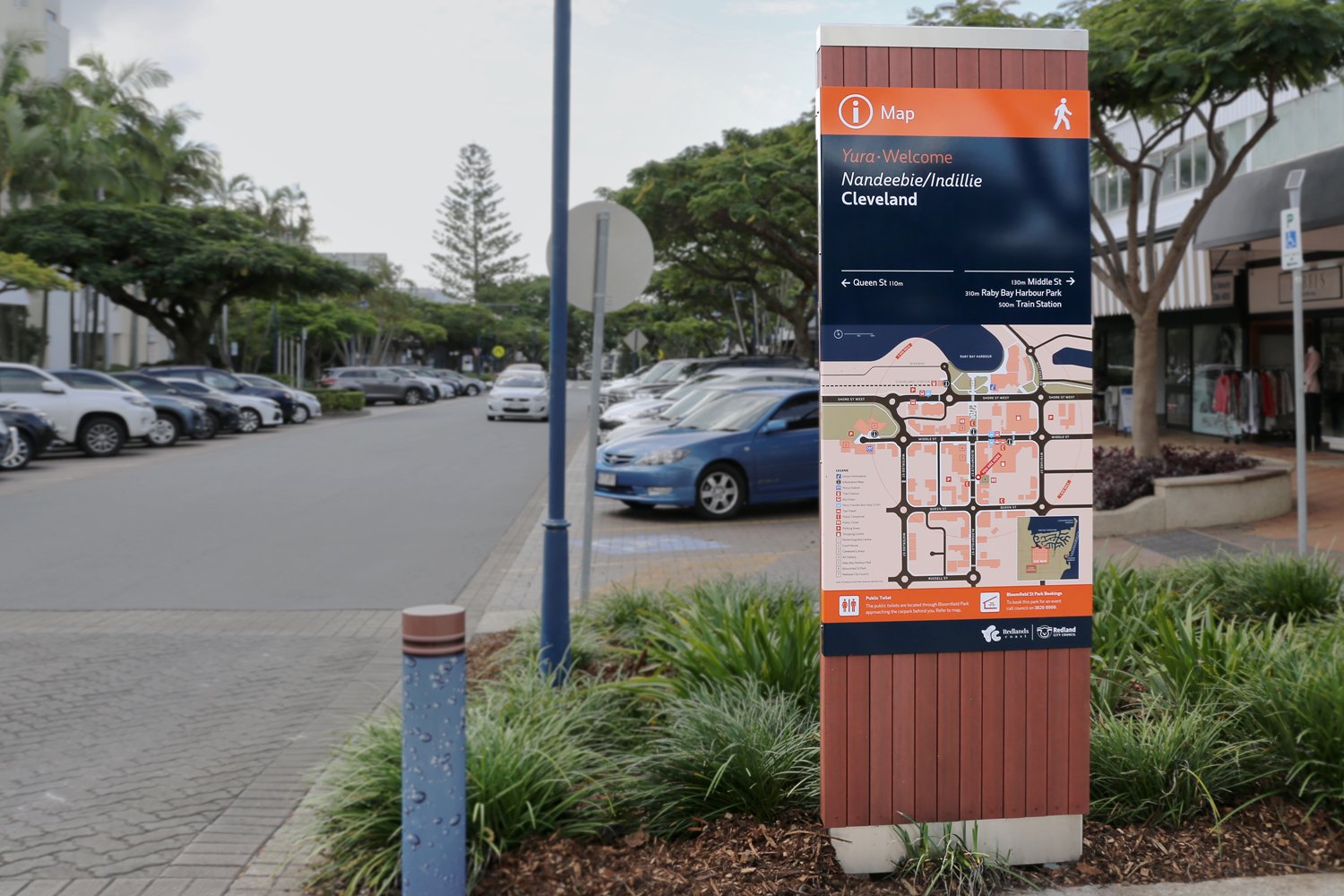
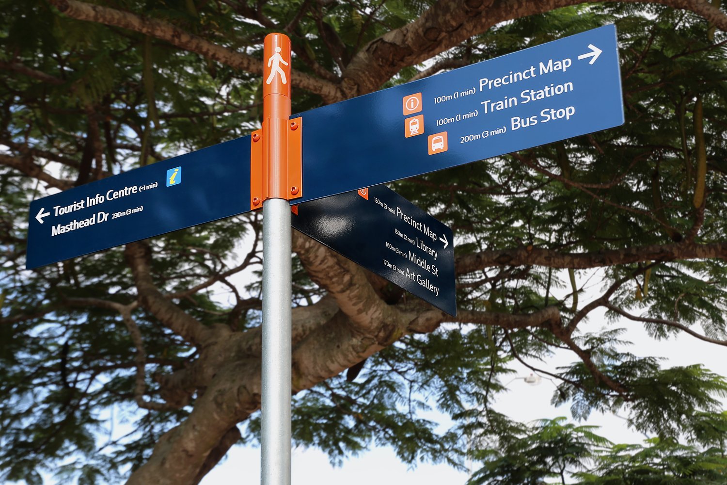
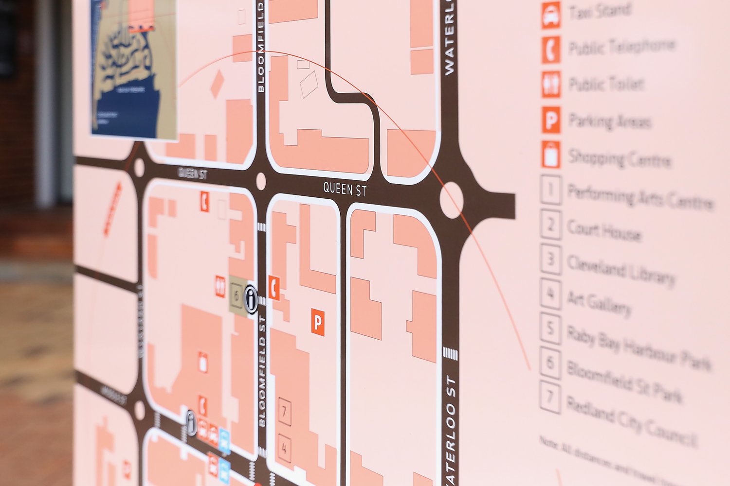
The CBD of Cleveland sits at the terminus of a train line of the same name and is a gateway to nearby Moreton Bay and associated islands.
Client: Redland City Council
Location: Redland QLD
This attracts a large number of tourists and day-trippers to these streets. Visitors who may be unfamiliar with the area and need assistance navigating it on foot.
We developed a wayfinding strategy and content strategy for the precinct including the development of an orientation map.
This project is part of the Redland Signage Manual project also developed by MODE.